KARAKORUM ROAD
Located @ PAKISTAN
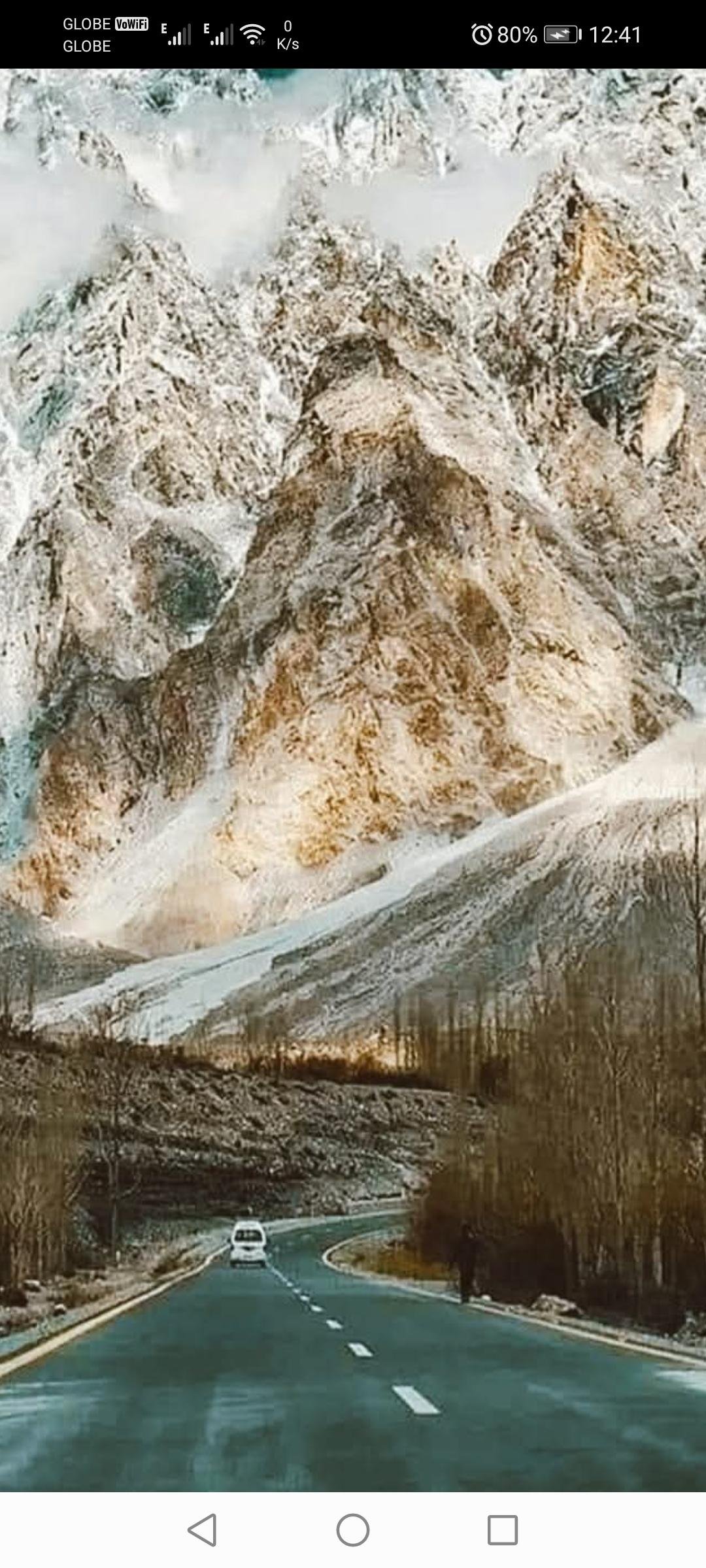
The Karakoram Highway, also known as the KKH (Karakoram Highway), is much more than a means of communication; it's a magical corridor that connects two of the most imposing mountain ranges on the planet: the Himalayas and the Karakoram. This engineering masterpiece, considered the world's tallest paved road, reaches altitudes of over 4,800 meters. The fascinating thing is that, besides its impressive height, this route follows one of the ancient Silk Routes, becoming a journey down memory lane for adventurers who dare to travel it.
Few know that the construction of this road was a joint effort between Pakistan and China, carried out between 1959 and 1979. During its construction, more than 800 workers lost their lives due to extreme conditions. Today, the road not only connects both countries but also local cultures, offering travelers the opportunity to experience the rich diversity of the villages that inhabited this region, such as the Burushaski, Shina, and Wakhi.
Trekking the Karakorum is not just a scenic journey, but also an encounter with unique natural wonders. From the imposing glaciers like the Passu and the Batura to the spectacular landscapes of the Hunza Valley, every kilometer reveals views that look like straight out of a postcard. In addition, this road offers an access point to Nanga Parbat, the ninth highest mountain in the world, nicknamed the "Killer Mountain" due to its climbing difficulty.
For travellers looking to explore this region in 2024 it's important to keep some practical tips in mind. The best time to visit is between May and October, when the weather conditions are more favorable and the roads are clear of snow. It is essential to wear appropriate clothing for the extreme cold, as even in summer, the nights can be cold. Also, it's recommended to hire a local guide, especially if you plan to detour on less-traffic trails.
Safety is another important aspect to consider. Although the region is known for its hospitality, some areas close to the border may have access restrictions. It's essential to be informed about local regulations and register your presence if you travel to remote areas. Also, since mobile communications are limited in many parts of the road, carrying a GPS navigation device and a physical map is a smart precaution.
Traversing the Karakorum is an unforgettable experience that combines the majesty of nature with cultural richness and millennium history. Beyond its spectacular views, this route is an invitation to connect with the deep roots of humanity, where mountains tell stories and winds carry echoes of past civilizations. If you've ever dreamed of an adventure that transforms your perspective, this destination should be on your list.
#pakistán #carreteradekarakorum #viajesaventura #paisajesincreíbles #turismodealtura #montañaskarakorum #rutasdelaseda #valledehunza #lacubanitaviajera
🇵🇰🇵🇰 KARAKORUM ROAD🇵🇰🇵🇰
👇👇Located @ PAKISTAN👇👇
👇👇👇👇👇👇👇👇
The Karakoram Highway, also known as the KKH (Karakoram Highway), is much more than a means of communication; it's a magical corridor that connects two of the most imposing mountain ranges on the planet: the Himalayas and the Karakoram. This engineering masterpiece, considered the world's tallest paved road, reaches altitudes of over 4,800 meters. The fascinating thing is that, besides its impressive height, this route follows one of the ancient Silk Routes, becoming a journey down memory lane for adventurers who dare to travel it.
Few know that the construction of this road was a joint effort between Pakistan and China, carried out between 1959 and 1979. During its construction, more than 800 workers lost their lives due to extreme conditions. Today, the road not only connects both countries but also local cultures, offering travelers the opportunity to experience the rich diversity of the villages that inhabited this region, such as the Burushaski, Shina, and Wakhi.
Trekking the Karakorum is not just a scenic journey, but also an encounter with unique natural wonders. From the imposing glaciers like the Passu and the Batura to the spectacular landscapes of the Hunza Valley, every kilometer reveals views that look like straight out of a postcard. In addition, this road offers an access point to Nanga Parbat, the ninth highest mountain in the world, nicknamed the "Killer Mountain" due to its climbing difficulty.
For travellers looking to explore this region in 2024 it's important to keep some practical tips in mind. The best time to visit is between May and October, when the weather conditions are more favorable and the roads are clear of snow. It is essential to wear appropriate clothing for the extreme cold, as even in summer, the nights can be cold. Also, it's recommended to hire a local guide, especially if you plan to detour on less-traffic trails.
Safety is another important aspect to consider. Although the region is known for its hospitality, some areas close to the border may have access restrictions. It's essential to be informed about local regulations and register your presence if you travel to remote areas. Also, since mobile communications are limited in many parts of the road, carrying a GPS navigation device and a physical map is a smart precaution.
Traversing the Karakorum is an unforgettable experience that combines the majesty of nature with cultural richness and millennium history. Beyond its spectacular views, this route is an invitation to connect with the deep roots of humanity, where mountains tell stories and winds carry echoes of past civilizations. If you've ever dreamed of an adventure that transforms your perspective, this destination should be on your list.
#pakistán #carreteradekarakorum #viajesaventura #paisajesincreíbles #turismodealtura #montañaskarakorum #rutasdelaseda #valledehunza #lacubanitaviajera 🇵🇰

·143 Visualizações
·0 Anterior


